

|
|
|
|
|
|

|
|
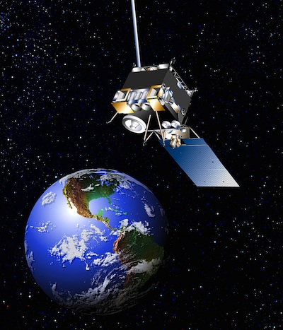
NOAA turns to backup after weather satellite glitch BY STEPHEN CLARK SPACEFLIGHT NOW Posted: May 23, 2013 A week before the official start of a potentially active Atlantic hurricane season, the primary U.S. weather satellite keeping watch over the tropics has stopped collecting imagery, NOAA officials said Thursday.
"It appears to have been a problem with the star tracker, which caused the satellite to lose its position hold capability," said Kathryn Sullivan, acting NOAA administrator. The spacecraft is positioned in geostationary orbit 22,300 miles over the equator at 75 degrees west longitude, viewing a swath of Earth stretching from central United States to the eastern Atlantic Ocean. NOAA engineers activated the spare GOES 14 satellite and started collecting imagery with it Thursday, restoring real-time views of weather over the eastern United States and much of the Atlantic Ocean. "We are not blind," Sullivan said. "Forecasting is not materially affected." GOES 14 is located at a hover point at 105 degrees west longitude, meaning its imaging and sounding sensors see less of the Atlantic Ocean than GOES 13. NOAA declared the GOES 14 satellite operational early Thursday, according to a status report posted on the agency's website. Sullivan said Thursday ground controllers were still refining navigation data from GOES 14 to permit rapid-scan operations, a special mode of imaging in which the satellite takes close-up pictures every 5 minutes to watch fast-developing storms. GOES satellite normally return wide-view images every 15 minutes. Sullivan highlighted the importance of rapid-scan imaging, noting the special mode was used during Monday's tornado outbreak in Oklahoma. In an interview Thursday, Renkevens said engineers are studying the problem with GOES 13 determine its root cause before deciding what steps to take to recover the satellite. The spacecraft is otherwise healthy and engineers are in contact with the satellite, he said. "The primary satellite team is now turning its attention back to GOES 13 to dig into the engineering data with Boeing, the company that produced the satellite, and drive down to root cause to what happened there," Sullivan said in a press conference Thursday to unveil NOAA's outlook for the 2013 Atlantic hurricane season. Forecasters predict between 13 and 20 named storms in the Atlantic, Caribbean Sea and Gulf of Mexico in the upcoming hurricane season, which begins June 1. The Geostationary Operational Environmental Satellites are used by meteorologists to monitor severe weather, tropical cyclones and other weather systems. The GOES system also supplies the satellite imagery used on television broadcasts. NOAA keeps two geostationary satellites operational at a time. The satellite positions, named GOES East and GOES West, give forecasters views of weather from west of Hawaii to the west coast of Africa. NOAA typically holds at least one satellite in reserve in case of a problem. If the problem with GOES 13 takes time to fix, NOAA officials could decide to move GOES 14 to the GOES East position to return imagery of a wider portion of the Atlantic Ocean, especially the region nicknamed 'hurricane alley' off the west coast of Africa. "If this period goes long enough, we will begin to reposition GOES 14 further east so that its field-of-view is fully covering the normal Atlantic hurricane development region," Sullivan said. Until then, Renkevens said, meteorologists can use images of the far eastern Atlantic from Europe's Meteosat 10 weather satellite. NOAA's polar-orbiting satellites, which collect intermittent imagery of a given location several times a day, also ensure forecasters know what is going on in one the Atlantic's most turbulent hurricane development zones. "Convective outlook for the United States at this present time is benign," Sullivan said. "So we have this window of time to work on both diagnosing the problem and consider whether we need to reposition GOES 14." GOES 13 was out of service for three weeks in September and October due to a glitch in the observatory's atmospheric sounding instrument. Engineers devised a way to resolve the problem, and GOES 13 resumed full operations in mid-October. The GOES 13 satellite launched on a Delta 4 rocket in May 2006. Built by Boeing Co., the spacecraft is designed for a 10-year lifetime. |
|
|
|
|
||||||||||||||||||||||||||||||||||||||||||||||||||||||||||||||||||||||||||||||||