|
|
|

|
|
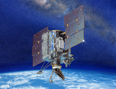
Wind sensor failure ends long-lived satellite mission BY STEPHEN CLARK SPACEFLIGHT NOW Posted: November 24, 2009 A spinning antenna on NASA's QuikSCAT satellite has failed after more than a decade of operations, leaving weather forecasters without a critical tool to measure winds inside distant hurricanes and adding fuel to a political firestorm on a potential replacement.
"Seventy percent of the Earth's surface is covered by the ocean, and we actually have very few direct measurements of winds over the ocean, except for satellites such as QuikSCAT," said Michael Freilich, director of the Earth Science division at NASA Headquarters. NASA officials attribute the failure to the age of bearings inside the spacecraft's SeaWinds scatterometer instrument. QuikSCAT was launched on a Titan 2 rocket in 1999 for a two-year mission, but the satellite's life was extended because it provided key data for computer models in hurricane predictions. "When these data started to be assimilated into not only the nation's, but the world's, operational numerical weather prediction models, and when they started to be used by the subjective analysts at the forecast offices in coastal areas, forecast accuracy improved measurably," Freilich said. Engineers have been monitoring increasing friction in the instrument over the past few months. The friction was putting more strain on the motor driving the antenna, which is about 3 feet in diameter. The antenna features two spot beams that sweep in a circular pattern at about 18 rpm. The antenna ultimately stopped spinning about 0700 GMT Monday, according to Robert Gaston, the QuikSCAT project manager at the Jet Propulsion Laboratory. "I think the chances are pretty remote that we'll see this antenna rotate again," Gaston said. Winds can be derived from the brightness of the radar returns from the instrument. The QuikSCAT mission was launched with a two-year mission goal. Its radar instrument spin mechanism was designed to last five years. Attempts to restart the antenna so far have been unsuccessful, Gaston said. If NASA is unable to recover the antenna, QuikSCAT's primary mission will come to an end. The spinning scatterometer is required for estimating wind speed and direction across 90 percent of the Earth's surface every day, according to NASA. "At that point, the data from the system was no longer of use to the NOAA operational forecasters and the reason is that without that spinning antenna, we don't have the wide 1,800-kilometer (1,118-mile) swath that's needed to do the operational data processing."
"For example, degraded scatterometer measurements from QuikSCAT can still be useful for cross-calibrating the mission's climate data record with measurements from other scatterometers," NASA said in a statement. According to the mission's Web site, the QuickSCAT payload could detect winds from 7 mph to 45 mph with an accuracy of less than 5 mph in velocity and 20 degrees in direction. The National Oceanic and Atmospheric Administration was in charge of utilizing QuikSCAT's data in operational forecasts and disseminating the information to international meteorological agencies. "What QuikSCAT did over a long period of time, with high accuracy and good spatial resolution, was to provide this global view of surface winds," Freilich said. "We also used the backscatter measurements from QuikSCAT for a variety of other important operational uses, such as ice mapping." QuikSCAT also had climate research applications, giving scientists new information on the interaction between the atmosphere and the ocean, according to Freilich. Built by Ball Aerospace and Technologies Corp., QuikSCAT was outfitted and launched as a gapfiller one year after its predecessor on a Japanese satellite ceased operating. A permanent replacement was launched on another Japanese satellite in 2002, but that spacecraft failed less than a year later, leaving the stopgap QuickSCAT mission in a much more permanent role. The development of a follow-on mission to QuikSCAT has been the focus of considerable controversy. NASA has studied fielding a replacement, identifying options to launch a similar satellite to QuikSCAT or build a more advanced scatterometer. A former head of the National Hurricane Center, Bill Proenza, was an outspoken advocate for a replacement to the aging QuikSCAT satellite. Proenza cited statistics indicating the loss of QuikSCAT data would reduce the accuracy of hurricane predictions, but other experts said Proenza overstated the impact of a QuikSCAT failure. Proenza was removed from his post at the National Hurricane Center after six months on the job in 2007. A 2008 NASA study of the the mission showed "measurements from QuikSCAT are an intrinsic part of everyday forecasting and warning processes at (National Weather Service) operational centers and offices."
It would also have a negative impact on the aerial extent and the wind strength forecasts over the North Atlantic, North Pacific and Gulf of Alaska waters, the study said. The National Research Council's decadal survey recommended NOAA and NASA develop a temporary solution to extend QuikSCAT's data record and build an advanced mission with a more capable scatterometer with improved resolution and better accuracy, particularly within hurricanes and near coastlines. Called the Extended Ocean Vector Winds Mission, the new spacecraft would be a long-term solution to the sea winds dilemma. But money may not be available to pay for such a mission, despite efforts in Congress to authorize a dedicated satellite. NASA is instead adding a scatterometer to a Japanese satellite called GCOM W2, scheduled for launch in 2016. Until then, U.S. forecasters will likely use wind data from scatterometers on the European MetOp satellites and India's Oceansat 2 spacecraft. Freilich said data-sharing agreements are in place with both missions, but the data quality may not match the performance of QuikSCAT. NOAA would lead efforts to build a U.S. free-flyer satellite, if such plans come to fruition, according to Freilich. |
|
|
|
|
||||||||||||||||||||||||