|
|
|
|
|
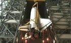
Canadian radar-imaging spacecraft launched BY STEPHEN CLARK SPACEFLIGHT NOW Posted: December 14, 2007 Canada's next-generation eye-in-the-sky satellite successfully soared into space at the tip of a Soyuz rocket Friday to collect the world's sharpest commercially available radar imagery. The Radarsat 2 satellite, running six years behind schedule due to an array of technical and political challenges, will produce imagery with resolutions nearly three times higher than its aging predecessor. The Radarsat 1 satellite has provided all-weather imagery of the globe for more than 12 years, or about seven years beyond the craft's life expectancy. The satellite remains in good health, but Radarsat 2 will ensure the system's commercial, civil and military users continue to receive reliable data for years to come, according to Canadian officials. "This satellite will help us vigorously protect our Arctic sovereignty as international interest in the region increases," said Colin Carrie, Parliamentary Secretary to the Minister of Industry. "It will also ensure the continuity of data services for government departments and a growing number of commercial clients in more than 60 countries worldwide." The Canadian Space Agency contributed $450 million to the project, but it is managed by McDonald, Dettwiler and Associates Ltd., or MDA. MDA also put up the rest of the money for the development and operation of the spacecraft. Originally scheduled to launch in 2001, Radarsat 2 endured several hardware delays and changes of its satellite contractor and launch services provider since 2000. Radarsat 2 was originally supposed to be launched aboard a Delta 2 rocket, but U.S. government worries of military applications of Radarsat 2 and technical issues with the booster conspired against that plan. Delta 2 rocket engineers discovered potentially damaging vibrations in 2005 that could harm Radarsat 2 during the launch sequence, forcing Canada to look for a new ride to space, said Steve Oldham, MDA's vice president and general manager. Canadian officials inked a new deal to fly the satellite aboard a Soyuz rocket in January 2006, setting the stage for Friday's launch. Radarsat 2's long wait finally ended at 1317 GMT (8:17 a.m. EST) when the Russian Soyuz rocket came to life and blazed a trail into the night sky above Baikonur Cosmodrome in Kazakhstan. The booster's three lower stages placed the payload and the Fregat upper stage in a suborbital flight path less than nine minutes into the mission. The Fregat ignited first to reach a stable transfer orbit, then again a half-hour later to deliver Radarsat 2 into its final orbital perch with an altitude of about 500 miles and an inclination of approximately 98.6 degrees. Separation of the 4,850-pound satellite occurred on schedule 53 minutes after liftoff. The satellite was scheduled to unfurl its two solar panels later Friday, followed by the deployment of the craft's radar antenna. Containing 512 individual radar transmitters and receivers, the nearly 50-foot-long steerable antenna is the centerpiece of the mission. Satellite-based radar systems are able to peer through clouds and darkness to collect imagery, an advantage over optical sensors that are only useful during daytime hours and good weather. Three months of testing and commissioning activities are scheduled before Radarsat 2 is declared operational early next year. Radarsat 2's imagery will be sold commercially to government and private users around the world through distributors. U.S.-based EMS Technologies Inc. was the subcontractor for the radar antenna and electronics systems, while Thales Alenia Space built the spacecraft bus in Europe. Radarsat 2's daily operations will be run by Telesat Canada, an Ottawa-based communications satellite operator. Radarsat 2 will be the first non-communications satellite under the company's control. During its seven-year mission, Radarsat 2's synthetic aperture radar system will send radar beams sweeping across the planet to gather data to produce detailed images that will resolve objects as small as 10 feet. Radarsat 2's improved image resolution is due to a new "ultra-fine" radar signal that can detect smaller objects and changes in terrain. The craft also features other radar beams providing a wide range of image resolutions and coverage areas. Other advances since Radarsat 1 include a new ability to steer the radar antenna on both sides of the craft's ground track, allowing the satellite to map swaths of land as wide as 300 miles during each pass. The wider areas of ground coverage also mean faster revisit times to keep updated imagery flowing to users. Four different radar polarization options on Radarsat 2 will give officials new settings that will better distinguish between certain types of objects. Radarsat 2 will also reduce lead times for urgent and emergency situations to just a handful of hours. Improvements in data storage, reception and analysis also mean that users can access Radarsat 2 products more quickly. The faster data turnaround time is a boon for defense customers and disaster management officials that rely on timely information, according to MDA. Radarsat 2 imagery will also keep tabs on crops, monitor the environment, and aid in terrain mapping. Technology advances in Radarsat 2 also give users a finer tool for tracking ships at sea and a better look at changes in sea and land ice. The Canadian military will use Radarsat 2 for foreign surveillance and tracking vessels approaching Canadian waters in the Arctic. The next step in the Radarsat program is slated to begin in 2012 with the launch of the first of three identical satellites as part of the Radarsat Constellation Mission. The follow-on program would enhance the system's ability to monitor shipping lanes for the Canadian military, provide data for emergency management officials, and observe the environment. |
|
|
|
|||||||||||||||||||||