|
 |
|
||||
|
|
||||
|
Floods at Mars' equator are recent, scientists say UNIVERSITY OF ARIZONA NEWS RELEASE Posted: February 19, 2002 Not only lava, but water has recently flooded from fissures near Mars' equator, University of Arizona scientists have discovered. And they're not talking about a trickle. They're talking possibly 600 cubic kilometers of water. That's one and a quarter times as much water as in Lake Erie, four times as much water as in Lake Tahoe, and 65 times as much water as in California's Salton Sea.
She and UA planetary scientist Alfred S. McEwen analyzed new Mars Orbital Camera (MOC) images near a series of fissures that stretch more than a thousand kilometers (600 miles) across the lava-covered Cerberus Plains just north of the martian equator. The images showed geologic evidence for catastrophic floods similar to catastrophic flood landforms on Earth. They and Susan Sakimoto of the NASA Goddard Space Flight Center have reported the research in Geophysical Research Letters. UA Regents' Professor Victor Baker and others concluded from Viking spacecraft images more than 20 years ago that great water floods must have carved huge channels draining into another region of the planet, Chryse Planitia. But photographic evidence consistently confirms that happened more than 2 billion years ago. Burr and McEwen analyzed the Athabasca Valles channel system that branches south and southwest from the Cerberus Fossae.
"What's different here is that this is very recent, and the water source is nothing like we have on Earth," she said. "The water here gushed from volcano-tectonic fissures. While the fissures themselves may be older, the latest eruption of water was probably only about 10 million years ago." "That's young," McEwen said. "If there is anyplace on Mars where there are current geothermal anomalies, I myself would look in the Cerberus Fossae first." Geothermal sites on Mars would be a striking discovery, for they would provide both heat and water on the cold, dry planet. "Flood volcanism on Earth occurs about every tens of millions of years," McEwen said. "The last such event was 10 million years ago. But that doesn't mean it's over. It will happen again. The same is probably true on Mars -- geologically speaking, it's still active." Tectonic forces, or a combination of tectonic and magmatic forces, likely created the fossae, or fissures, from which lava extruded over the Cerberus Plains, McEwen said.
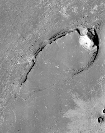
Researchers know of one other possible such volcanic/hydrologic channel system on Mars, Mangala Valles, also near the equator. But it, too, is older than Athabasca Valles. The most distinctive evidence for aqueous flooding are steamlined, flat-topped mesas in the middle of channels. These tear-drop shaped features are similar to structures in the Channeled Scabland in the northwestern United States, which Baker in 1982 reported were features created by catastrophic outflow of glacial meltwater. The Athabasca Valles streamlined mesas on Mars rise 100 meters (330 feet) above the channel floors at their upslope ends and range from a few hundred to a few thousand meters long. Their flat upper surfaces "support an aqueous origin rather than a glacial one," the scientists conclude in their paper. The mesas are composed of fine, horizontal layers behind impact craters, adding to evidence that were formed by deposition during flow in the lee of an object. Other streamlined forms, also layered but not flat-topped like the streamlined mesas, more likely were formed by erosion during floods over pre-existing layered terrain, Burr said.
All fluvial features were seen down slope, or southward, of the Cerberus Fossae. The fissures have such sharp edges and such steep slopes - more than 80 degrees - and cut through such young, lightly cratered lava plains that they must have been active recently, the researchers said. UA planetary sciences graduate student Peter Lanagan, McEwen and colleagues previously reported on "rootless cones" at the downstream ends of the channel. The martian cones are similar both in morphology and size to rootless cones in Iceland, features which form when surface lava interacts explosively with near-surface groundwater. The most plausible source of water that produced rootless cones on Mars is a catastrophic flood, they concluded. Because the flood water was debouched over permeable lava, much of it may have been absorbed by the lava and still persist in the Cerberus Plains as shallow ground ice, Burr, McEwen and Sakimoto conclude. The shallow ground ice and the record of recent geothermal activity are
likely present in the Cerberus Plains, making it an important target for
future Mars exploration, the UA scientists note. As leading astrobiologists
posit, "Both shallow ground ice and geothermal deposits are important
targets in the search for a record of Martian life."
|
|
|||||||