SPOT satellite images World Trade Center fires
SPACEFLIGHT NOW
Posted: September 12, 2001
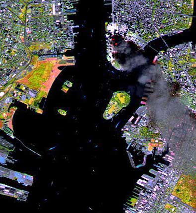
Credit: CNES/SPOT Image 2001
|
This SPOT satellite image of Manhattan, acquired on September 11 at 11:55 a.m. EST, three hours after two planes crashed into the World Trade Center. The colors result from the use of infrared bands to identify the actual fire hot spots (see red spots near the base of the smoke plume). The SPOT satellites orbit at an altitude of 822 km.
|
|
|
|

|