|
 |
|
||||
|
|
||||
|
NASA satellite technology goes down on the farm NASA/JPL NEWS RELEASE Posted: May 11, 2001
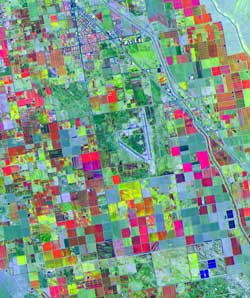
Farmers will soon get the chance to put the new system to the test through a partnership between NASA's Jet Propulsion Laboratory, Pasadena, Calif., and NavCom Technology Inc., a wholly owned subsidiary of Deere & Company, Moline, Ill. Tractors will be equipped with receivers providing instant location information, which is vital for precision farming. The technology will allow farmers to navigate fields at night and when visibility is poor. More importantly, with soil sensors and other monitors, it will let them calculate and map out precisely where their fields may need more water, fertilizer or weed control, saving both time and money. The system combines software developed by JPL and real- time global positioning system (GPS) data from the NASA Global GPS Network to produce corrections to the GPS orbits and clocks. These corrections are broadcast to people using communication satellites operated by NavCom, which has licensed the Internet-based Global Differential GPS software from JPL's parent institution, the California Institute of Technology in Pasadena, and plans to market the system this summer. "NASA's Earth Science Enterprise supports pioneering exploration and discovery of our home planet, while providing America and the world with practical societal benefits from our research," said Dr. Ghassem Asrar, associate administrator for the Office of Earth Sciences, NASA Headquarters, Washington, D.C. "Our agreement with NavCom will accelerate NASA's ability to develop, test and demonstrate the utility of global, real- time, precise GPS positioning for scientific and public applications," said John LaBrecque, manager, Solid Earth and Natural Hazards Program, NASA's Office of Earth Sciences. While existing GPS data can be used to locate a position within a few meters, the new Global Differential GPS system provides an instantaneous position to within 10 centimeters (4 inches) horizontally and 20 centimeters (8 inches) vertically anywhere on Earth. No other system provides the same combination of accuracy and coverage. In space, the new technology may enable improved performance by NASA's Earth-observing satellites. Since the satellites will have precise information on their position, the information may make onboard data processing more efficient and reduce the time needed to transmit the data to the ground. NASA also expects this new positioning technology to open the possibility for new airborne exploration techniques through more accurately controlled flights of airborne sensors. "In the area of natural hazard monitoring, real-time data from radar and ground networks of GPS receivers might provide the ability to monitor volcanic activity precisely and in real time, as well as the motion before, during and after major earthquakes," said Dr. Yoaz Bar-Sever, task manager of the NASA global differential GPS demonstration at JPL. The system's ability to provide precise positioning information in real time has a variety of potential commercial applications in aviation, marine operations, land management, transportation and agriculture. The Commercial Technology Office at JPL is responsible for the collaboration between JPL and NavCom, which will provide NASA with a continuous, GPS differential-correction signal and also will invest in improving the NASA GPS infrastructure. This collaboration is just one of several JPL programs designed to bring the benefits of the space program to American industry. NASA's Earth Science Enterprise, Washington, D.C., funds the development of the Global Differential GPS system. The Enterprise is a long-term research effort dedicated to understanding how human-induced and natural changes affect our global environment.
|
|
|||||